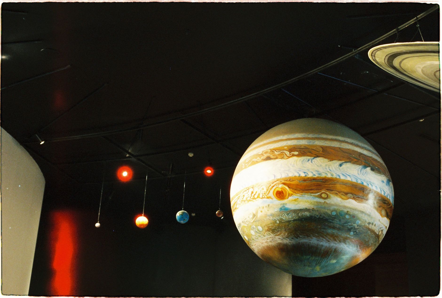
Planetary science is a field of study that has gained significant attention in recent years, with new discoveries and missions being launched to explore our solar system and beyond. The study of planets and their formation, composition, and evolution is crucial to understanding the universe and our place within it.
The solar nebula hypothesis is the most widely accepted theory of planet formation, which suggests that planets formed from a cloud of gas and dust that surrounded the Sun after its formation. This cloud, known as the solar nebula, collapsed under its own gravity, with the Sun forming at its center.
Planetary Differentiation
As the planets formed, they underwent a process known as differentiation, where heavier elements such as iron and nickel sank to the center, while lighter materials such as silicates rose to the surface. This process is responsible for the distinct compositions of the planets and their moons.
The solar system is a vast and complex system, consisting of eight planets, dwarf planets, asteroids, comets, and other smaller bodies. The inner planets, including Mercury, Venus, Earth, and Mars, are rocky and relatively small, while the outer planets, including Jupiter, Saturn, Uranus, and Neptune, are gas giants and much larger.
Mercury: the smallest planet, with a highly elliptical orbit
Venus: the hottest planet, with a thick atmosphere that traps heat
Earth: the only known planet to support life
Mars: a potential candidate for supporting life, with evidence of water and a habitable environment
Space Missions and Exploration
Space agencies such as NASA and the ESA have launched numerous missions to explore the solar system and beyond. These missions have greatly expanded our knowledge of the planets and their moons, and have provided valuable insights into the formation and evolution of the solar system.
NASA’s Voyager 1 and 2: launched in 1977 to study the outer planets and beyond
ESA’s Rosetta mission: launched in 2004 to study comet 67P/Churyumov-Gerasimenko
NASA’s Curiosity rover: launched in 2011 to study Mars and search for signs of life
Future of Planetary Science
The future of planetary science is exciting and promising, with new missions and technologies being developed to explore the solar system and beyond. The search for life on other planets and moons is a major focus of current and future missions, with the potential for groundbreaking discoveries that could change our understanding of the universe.
Planetary science is a dynamic and rapidly evolving field, with new discoveries and advances being made regularly. As we continue to explore and study the solar system, we may uncover secrets that have been hidden for billions of years, and gain a deeper understanding of our place within the universe.
Frequently Asked Questions
Here are some frequently asked questions about planetary science and the solar system:
Q: What is the largest planet in our solar system? A: Jupiter is the largest planet in our solar system, with a diameter of approximately 142,984 kilometers.
Q: Which planet is closest to the Sun? A: Mercury is the closest planet to the Sun, with an average distance of approximately 58 million kilometers.
Q: Is there life on other planets? A: While there is currently no definitive evidence of life on other planets, there are many reasons to believe that the possibility of life existing elsewhere in the universe is quite high.
Conclusion
In conclusion, planetary science is a fascinating and rapidly evolving field that has greatly expanded our knowledge of the solar system and beyond. With new missions and technologies being developed, the future of planetary science is exciting and promising, with the potential for groundbreaking discoveries that could change our understanding of the universe. As we continue to explore and study the solar system, we may uncover secrets that have been hidden for billions of years, and gain a deeper understanding of our place within the universe.
Ticking with Precision: Exploring the Atomic World Clock
Ticking with Precision: Exploring the Atomic World Clock
Imagine a world where every second is measured with an error smaller than a single grain of sand shifting in a desert. That world exists today, thanks to the Atomic World Clock. In this deep‑dive, we’ll uncover how atomic timekeeping works, why it matters to GPS navigation, financial markets, and scientific research, and how you can leverage this knowledge for better digital synchronization in your business.
Why Atomic Time Matters to Everyone
Reliability: A deviation of just 1 µs can cause a $10 billion loss in high‑frequency trading.
Safety: Air traffic control systems rely on sub‑millisecond precision to avoid collisions.
Connectivity: 5G networks and IoT devices need synchronized clocks to function seamlessly.
These real‑world stakes make the Atomic World Clock more than a scientific curiosity—it’s the backbone of modern infrastructure.
What Is an Atomic Clock?
Fundamental Principle
Atomic clocks measure time by counting the vibrations of atoms—most commonly cesium‑133 or rubidium‑87—when they transition between energy states. This transition occurs at a fixed frequency: 9,192,631,770 cycles per second for cesium, which defines the SI second.
How It Works (Step‑by‑Step)
Atom Preparation: Atoms are heated and then slowed using laser cooling to near absolute zero.
State Excitation: A microwave cavity bombards the atoms with radiation tuned to the resonant frequency.
Detection: Sensors count how many atoms change state, feeding a feedback loop that locks a quartz oscillator to the atomic frequency.
Output: The stabilized oscillator drives the clock’s digital display and external time signals.
Key Components
Laser System: Provides the cooling photons.
Microwave Cavity: Generates the precise frequency.
Magnetic Shielding: Isolates the atoms from external fields.
Frequency Counter: Converts atomic vibrations into usable time data.
Today, more than 400 atomic clocks operate worldwide, forming the International Atomic Time (TAI) ensemble. These clocks exchange timing data via GPS, Two‑Way Satellite Time and Frequency Transfer (TWSTFT), and fiber‑optic links, producing a unified time scale.
From TAI to UTC
TAI is a pure atomic timescale. To align with Earth’s rotation, Coordinated Universal Time (UTC) adds leap seconds when needed. The Atomic World Clock thus bridges the gap between celestial mechanics and quantum precision.
Real‑World Applications
Navigation & GPS
GPS satellites carry rubidium and cesium clocks. A timing error of 1 ns translates to a 30 cm positional error—critical for autonomous vehicles and drone delivery.
Financial Markets
High‑frequency traders use Precision Time Protocol (PTP) and IEEE 1588 to timestamp trades. Regulators (e.g., SEC) require sub‑microsecond timestamps to detect market manipulation.
Scientific Research
Gravitational Wave Detection: LIGO’s timing relies on atomic clocks to correlate signals across continents.
Fundamental Physics: Tests of General Relativity use atomic clocks at different altitudes to measure time dilation.
Geodesy: Optical clocks can map Earth’s gravitational potential with centimeter‑level accuracy.
Telecommunications
5G base stations synchronize via Network Time Protocol (NTP) and PTP, both anchored to atomic time. This ensures seamless handoffs and low latency.
Future Trends in Atomic Timekeeping
Optical Clocks
Optical lattice clocks using strontium or ytterbium achieve 10⁻¹⁸ fractional uncertainty—equivalent to losing a second over the age of the universe. Researchers aim to replace cesium as the new definition of the second.
Portable Optical Clocks
Miniaturized optical clocks are being tested on aircraft and satellites, promising real‑time relativistic geodesy and ultra‑precise navigation.
Quantum Time Transfer
Entangled photons could enable secure, zero‑delay time transfer across continents, eliminating the need for traditional satellite links.
AI‑Driven Clock Management
Machine learning algorithms now predict and correct clock drift in real time, improving reliability for data centers and cloud services.
How Businesses Can Leverage Atomic Precision
Step‑by‑Step Guide
Audit Your Timing Needs: Identify systems requiring sub‑millisecond accuracy (e.g., trading platforms, IoT fleets).
The second is defined by the cesium‑133 hyperfine transition: 9,192,631,770 cycles of radiation.
How often are atomic clocks calibrated?
National labs calibrate their primary standards continuously, while commercial stratum‑1 servers receive updates every few seconds via GPS or fiber links.
Can I use an atomic clock at home?
Consumer‑grade rubidium clocks are available for hobbyists, but they are still orders of magnitude less accurate than laboratory standards.
What is a “leap second” and why does it matter?
A leap second is added (or rarely subtracted) to keep UTC within 0.9 seconds of UT1, the Earth‑rotation‑based time. Without it, GPS and astronomical observations would drift.
Will optical clocks replace cesium clocks soon?
Experts predict a transition within the next decade, once optical clocks become robust enough for continuous operation.
Conclusion: Time Is No Longer a Mystery
The Atomic World Clock has turned time from a vague concept into a quantifiable, controllable resource. From nanosecond‑level GPS positioning to financial market integrity, the ripple effects of atomic precision are felt across every sector.
By understanding the technology, staying aware of emerging trends, and implementing best‑practice synchronization, you can future‑proof your operations and gain a competitive edge.
Inside a cesium atomic clock – the heart of modern timekeeping.GPS satellites carry atomic clocks that keep your navigation accurate.Next‑generation optical lattice clock – a trillionth of a second precision.
RealTimeSolar is a free web app that brings the mechanics of the sky to your screen in real time. It combines a millisecond-accurate world clock, a live tracker of the planets as they orbit the Sun, precise sunrise and sunset calculations, and a zodiac and astrology calculator, all layered with optional AI-generated cosmic insights. Whether you need to coordinate a meeting across three continents, find the next golden hour for a photograph, or simply understand where Jupiter sits tonight, everything updates continuously and calculates from established astronomical models rather than static tables.
At its heart, RealTimeSolar is a set of connected tools that answer questions about time and celestial position. Each tool works independently, but together they form a single reference for anyone who wants to know what the sky and the clock are doing right now, anywhere on Earth. Nothing here relies on guesswork or cached snapshots; the app recomputes positions and times from mathematical models every time you load it, and many views refresh several times per second.
The platform is organized around five core capabilities:
Live world clock — a time display synchronized to reference time servers and accurate to the millisecond, covering every IANA time zone so you can read the exact local time in hundreds of cities at once.
Real-time solar-system tracker — a running model of the planets' positions along their orbits, computed from J2000-epoch Keplerian orbital elements, so the arrangement you see reflects the actual current geometry of the solar system.
Sunrise, sunset and solar position — location-aware calculations of when the Sun rises and sets, plus its altitude and azimuth throughout the day, including twilight phases and solar noon.
Zodiac and astrology calculator — a tool that maps a date (and optionally a time and place) to zodiac signs and related astrological information based on the Sun's ecliptic longitude.
AI cosmic insights — plain-language interpretation and context that turns raw astronomical data into readable summaries and explanations.
Because everything runs in the browser, there is nothing to install and no account required to get started. You open a page, allow location access if a tool needs it, and the calculations begin immediately.
The phrase "real time" is used loosely on a lot of websites, so it is worth explaining what it means here. Two separate systems drive the app: one keeps track of time with high precision, and the other keeps track of space — the positions of celestial bodies. Both run continuously in your browser and update the display as the underlying values change.
Keeping accurate time with NTP synchronization
Your computer's own clock drifts. Consumer devices can be seconds or even minutes off from true time, because the quartz oscillators inside them are affected by temperature and age, and they are not always corrected promptly. For a normal calendar this does not matter, but for a clock that claims millisecond accuracy it matters a great deal.
To solve this, RealTimeSolar's clock aligns itself with reference time using the same principle behind the Network Time Protocol (NTP). NTP works by measuring the round-trip delay between your device and a time source, then estimating the offset between your local clock and the reference. By accounting for network latency in both directions, it can correct your displayed time far more precisely than the raw device clock allows. The result is a clock that tracks Coordinated Universal Time (UTC) closely and then converts it into whatever local zone you select.
Time zones themselves come from the IANA Time Zone Database, the same authoritative dataset used by operating systems and programming languages worldwide. It encodes not just the standard offset from UTC for each region but also the historical and scheduled rules for daylight saving time, so the local time you see reflects the correct rules for that place on that date.
Placing the planets with J2000 orbital calculations
The solar-system tracker uses a different kind of math. Every planet follows an elliptical orbit around the Sun, and that orbit can be described by a small set of numbers called Keplerian orbital elements: the size of the ellipse (semi-major axis), its shape (eccentricity), its tilt and orientation in space (inclination, longitude of the ascending node, argument of perihelion), and where the planet sits along the orbit at a reference moment (mean anomaly).
Those reference values are defined at a standard instant astronomers call the J2000 epoch — precisely 12:00 Terrestrial Time on 1 January 2000. Starting from that snapshot, the app advances each planet forward using Kepler's laws of orbital motion. It calculates how far along its orbit each planet should be at the current moment, solves Kepler's equation to convert that into a real position, and projects the result into coordinates you can visualize. Because the calculation is anchored to a well-defined epoch and driven by the current time, the layout you see is a faithful model of where the planets actually are, not a decorative animation.
In plain terms: the clock tells the app when now is, and the orbital math turns that "when" into where every planet sits along its path around the Sun.
The world clock is the most immediately useful tool for everyday life. It shows a continuously ticking time display and lets you compare multiple zones side by side. Because it is synchronized to reference time and built on the IANA database, it handles the awkward cases automatically — half-hour and 45-minute offsets, regions that do not observe daylight saving, and the exact date a clock change takes effect.
The solar-system tracker
The tracker presents the planets in their current orbital arrangement. You can see which planets are on the same side of the Sun, which are in opposition or conjunction from Earth's viewpoint, and roughly how the inner and outer planets are distributed. It is a fast, intuitive way to build a mental picture of the solar system as a moving system rather than a fixed diagram in a textbook.
Sunrise, sunset and solar position
Given a location, the app calculates the Sun's path for the day: the moments of sunrise and sunset, solar noon when the Sun is highest, and the sequence of twilight phases before dawn and after dusk. It can also report the Sun's altitude (its angle above the horizon) and azimuth (its compass direction) at any moment, which is exactly the information needed to predict shadows, plan photography, or orient a solar panel.
The zodiac and astrology calculator
The zodiac tool connects the calendar to the sky. The familiar Sun signs are defined by the Sun's position along the ecliptic — the apparent yearly path it traces against the background stars. Given a birth date, the calculator determines the corresponding zodiac sign, and with a birth time and place it can provide additional detail. It is designed for people curious about astrology as well as those who simply want to understand the astronomical basis behind the signs.
AI cosmic insights
Raw numbers — an azimuth of 118 degrees, a planet's heliocentric longitude — are precise but not always meaningful to a casual reader. The AI insights layer translates that data into readable language, offering context, explanations, and summaries that help you interpret what the tools are showing. It is meant to complement the calculations, never to replace the underlying science.
Who Uses RealTimeSolar
The platform serves a surprisingly broad audience because time and the sky touch almost every activity. A few of the groups who find it useful:
Travelers checking the local time and daylight hours at their destination before they arrive, and adjusting to new time zones.
Remote teams and distributed workers scheduling calls across zones without the usual mental arithmetic and daylight-saving mistakes.
Astronomers and stargazers wanting to know where the planets are, when the sky will be dark, and how the Sun's position affects observing conditions.
Students and educators exploring orbital mechanics, the causes of the seasons, and how time zones work, with a live model instead of a static illustration.
Solar-energy users and gardeners who need accurate sunrise, sunset, and solar-angle data to position panels, plan irrigation, or understand light in a space.
Photographers hunting the golden hour and blue hour, when the Sun's low angle produces the best light.
Astrology enthusiasts curious about their signs and the celestial context behind them.
What unites these users is a need for information that is both accurate and current. A screenshot of the sky from last week or a clock that is a few seconds off can be good enough for many purposes, but for coordination, observation, and planning, the difference between "close" and "exact" is the whole point.
How to Use Each Tool
Every tool is designed to give a useful answer within a few seconds. Here is a short walkthrough for each.
Using the world clock
Open the clock and let it synchronize; it aligns to reference time automatically.
Select the cities or time zones you care about to see them displayed together.
Compare the local times at a glance, or use them to pick a meeting slot that works everywhere.
Using the solar-system tracker
Open the tracker to see the planets in their current positions around the Sun.
Note which planets cluster together and which sit on opposite sides — this reflects the actual present-day geometry.
Return over days or weeks to watch the slower outer planets shift and the inner planets race around.
Using sunrise, sunset and solar position
Provide your location, either by allowing the browser to detect it or by entering a place.
Read off today's sunrise, solar noon, and sunset times, along with the twilight phases.
Check the Sun's current altitude and azimuth to know exactly where it sits in your sky right now.
Using the zodiac calculator
Enter a date of birth, and a time and place if you have them.
Read the resulting zodiac sign and the accompanying details.
Use the AI insights to get a plain-language explanation of what the result means and its astronomical basis.
Why Real-Time Accuracy Matters
It is easy to underestimate how much small timing errors add up. A clock that is five seconds fast will make you join calls early or, worse, cause automated systems to disagree about the order of events. In finance, telecommunications, and scientific measurement, sub-second timing is a hard requirement, which is precisely why the Network Time Protocol exists and why global infrastructure invests so heavily in keeping clocks aligned to UTC.
For the sky, accuracy matters in a different way. The Sun's position changes by roughly a quarter of a degree every minute, so a sunrise time that is off by ten minutes points you toward the wrong patch of horizon. The planets move constantly too; an outdated diagram might show a planet on the far side of the Sun when it has, in fact, come around to our side. By recomputing from current time and validated models, RealTimeSolar keeps its answers honest.
There is also an educational value in seeing things update live. When you watch the second hand of a synchronized clock or notice a planet's position drift over a week, the abstract idea that the cosmos is a system in continuous motion becomes concrete and intuitive.
The Science in Brief
A little background makes the tools more rewarding to use. Here are the key ideas the app is built on, kept short.
Time and UTC
Coordinated Universal Time (UTC) is the global time standard, maintained by atomic clocks and kept close to the Earth's rotation. Local time is simply UTC plus or minus an offset, adjusted for daylight saving rules. Every accurate clock, including this one, ultimately expresses time as an offset from UTC.
Kepler's laws and orbits
In the early seventeenth century Johannes Kepler discovered that planets move in ellipses with the Sun at one focus, that they sweep out equal areas in equal times (moving faster when closer to the Sun), and that the square of a planet's orbital period is proportional to the cube of its orbit's size. These three laws are enough to predict where a planet will be, and they are exactly what the solar-system tracker applies.
The Sun's apparent motion
The Sun's daily arc across the sky and its slow yearly journey along the ecliptic both result from the Earth's own motions — its rotation on a tilted axis and its orbit around the Sun. That axial tilt is what gives us seasons and what makes sunrise and sunset times shift through the year. The same ecliptic path, divided into twelve segments, is the origin of the zodiac.
Reference frames and the J2000 epoch
To describe positions in space you need a fixed reference. Astronomers use standardized epochs, and J2000 — the start of the year 2000 in a precise time scale — is the modern standard. Orbital elements and star positions given "at J2000" can be advanced to any later moment, which is how a fixed dataset from the year 2000 can tell you where a planet is today.
Privacy and Access
RealTimeSolar is free to use and runs in your web browser. Tools that depend on your location, such as the sunrise and sunset calculator, ask for that information only to perform the calculation, and you can enter a location manually if you prefer not to share it automatically. The core clock and solar-system tracker work without any personal data at all. There is nothing to download, and the calculations happen live each time you visit.
Frequently Asked Questions
Q: How accurate is the world clock? A: The clock synchronizes to reference time using the same offset-and-latency principle as the Network Time Protocol, correcting for your device's own drift. In practice this brings it to within milliseconds of true UTC, far closer than an unsynchronized computer clock, and it converts that time into any IANA time zone you select.
Q: Are the planet positions real or just an animation? A: They are real calculations. The tracker starts from published J2000-epoch Keplerian orbital elements and applies Kepler's laws to advance each planet to its position at the current moment, so the arrangement you see reflects the actual present-day geometry of the solar system rather than a looping graphic.
Q: Do I need to create an account or install anything? A: No. Everything runs in your browser with no installation and no account. Some tools ask for your location to calculate results for your exact spot, but the clock and solar-system tracker work immediately without any personal information.
Q: What is the J2000 epoch and why does it matter? A: J2000 is a standard reference instant — noon on 1 January 2000 in a precise astronomical time scale — at which the orbital elements of the planets are defined. Because the math can carry those values forward from that fixed starting point to any later date, a single well-defined snapshot is enough to compute accurate positions for today and beyond.
Bringing Time and Sky Together
RealTimeSolar exists to make the invisible clockwork of time and the solar system visible and usable. It answers practical questions — what time is it there, when does the Sun rise, where are the planets tonight — with the same rigor an astronomer or a network engineer would demand, and it wraps that rigor in tools anyone can open and understand. Explore the world clock for your next trip, watch the planets move along their orbits, plan around the Sun, or dig into the astronomy behind your zodiac sign; whichever tool you reach for, it is drawing on real synchronized time and real orbital science to show you the cosmos as it is, right now.